Hotels in Tungkillo, South Australia
Tungkillo Hotel
The Tungkillo Hotel in Tungkillo, Australia is closed as a hotel and has been fully restored into a private residence. Local resident Peter Janetzki undertook a multi-year renovation of the historic pub, which was originally built in 1856. The...

Information on Tungkillo, SA 5236
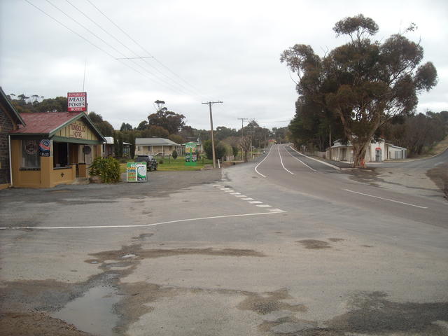
Main Street
Photo July 2011, submitted by gaz Pope, Many Thanks
Tungkillo is a small rural town in South Australia, located approximately 5 km south of Mount Pleasant, 60 km northeast of Adelaide. With a population of around 360 residents, this peaceful township sits at an altitude of 391m in the Adelaide Hills region. The name derives from "tainkila," an indigenous Peramangk term meaning "ghost moth grubs".
Originally established around mining activities in the 1840s, Tungkillo today serves as a quiet rural community offering a gateway to the Adelaide Hills, Barossa Valley, and Murraylands regions.
Local tourism links
Travel options
Tungkillo sits on Adelaide-Mannum Road, providing direct road access from Adelaide (60km) and nearby towns. The town is easily accessible by car via scenic country roads through the Adelaide Hills.
Mount Pleasant, just 5km north, serves as the main transport hub with connections to Adelaide Hills, Barossa Valley, and Murraylands regions. Public transport options are limited, making private vehicle the most practical travel option for visitors exploring this rural area.
- Palmer (9km)
- Birdwood (10km)
- Mount Torrens (12km)
- Springton (13km)
- Kersbrook (20km)
- Woodside (23km)
- Mannum (24km)
- Callington (33km)
- Sandy Creek (33km)
- Verdun (33km)