The Dandenongs Pub Trail
Bayswater / The Basin / Sassafras / Olinda / Mt Dandenong / Kalorama / Mt Dandenong / Olinda / Monbulk / The Patch / Kallista / Sherbrooke/ One Tree Hill / Tremont / Upper Ferntree Gully / The Basin
Submitted By: Gary Pope ... Many Thanks
This 60km trip (not really suitable for caravans**), takes the traveler over the entire scope of Mt Dandenong, including the Observatory viewing area on the peak, and a number of great attractions, pubs and eateries in the area. It is possible to do this trip in half a day without any serious stops. But if you like golf, gardens, mountain views, art or generally grazing/relaxing at the many B&B's you could well spend 2 or 3 days doing this itinerary.
Note: Please do not confuse Mount Dandenong (the town and mountain) with the township of 'Dandenong' - the latter being a major suburb about 20kms south of this area, and unrelated.
To lead you into the starting point and ending points for this round trip we assume you're travelling into the area from the Melbourne side of the hills. Note: You can pick up this itinerary from a number of other angles, including the Silvan Dam Pub Trail itinerary.
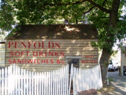
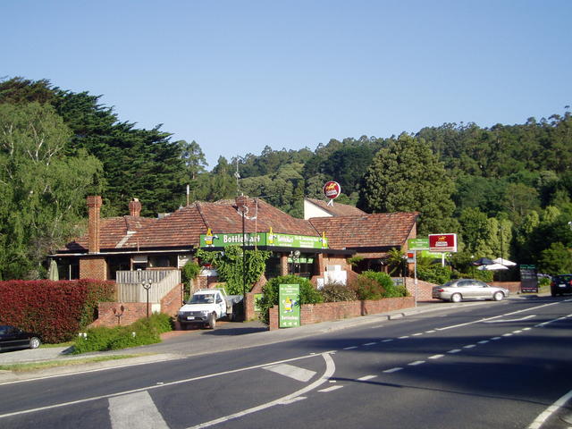
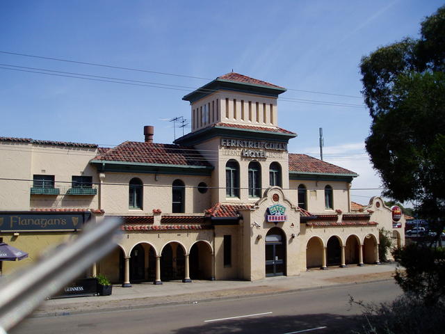
We start with a drive by of the historic Bayswater Wine Centre, which was used from 1899 as a stopover point to rest the horses for the coaches making their journey from Melbourne to Olinda. Presently this local iconic building operates as a bottle shop. It is on the Register of the National Estate with status: Historic, which presents some constraints on what developments can take place - but an interesting local piece of history!
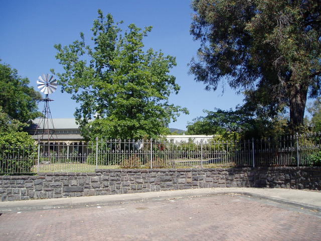
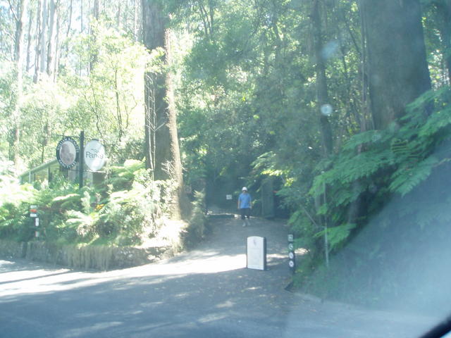
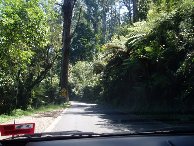
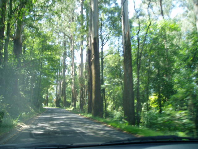
Heading up the Mountain Highway to The Basin you will come to the start and end points of the route outlined for this itinerary. We have placed an emphasis on the utilisation of the Mountain Highway as a recommended route, in lieu of Canterbury Rd, as the Highway winds up through some great views of Mount Dandenong as you ascend up to Sassafras.
This Pub Trail conveniently crosses the Silvan Dam trail that allows a North-South drive from Lilydale through Belgrave and via Emerald to Berwick. The Lilydale end of that trail leads to the Yarra Valley Wine area and beyond, or Warburton/Mt Donna Buang region - see the Warburton Pub Trail.
The Berwick end is great for access to the Princes Highway, or further south into the South Gippsland trail. Naturally, if coming in from the east, say from Lakes Entrance, and wishing to visit this area, then half that Silvan Dam itenerary can be done in reverse, up to Lilydale.
So, all these combined, travellers coming into this area can enjoy this itinerary of Mt Dandenong, without having to travel all the way into Melbourne, which we recommend that you do by catching public transport and then walking the great route we've outlined on the Melbourne Pub Trail. On a good clear day, you can see Melbourne's sky-scrapers clearly, from the observatory explained in this trail.
Ideal overnight accommodation is available at many places on the Mount Dandenong, particularly around the township of Olinda - making it a central area for reaching the many attractions, and many of the Pubs in the area provide excellent accommodation - so plan on spending a night or two!
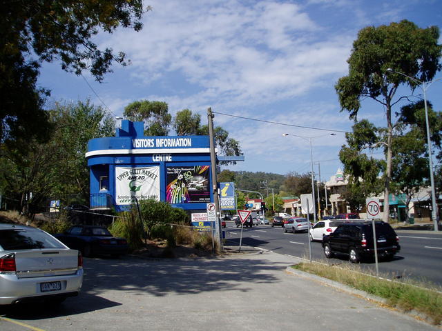
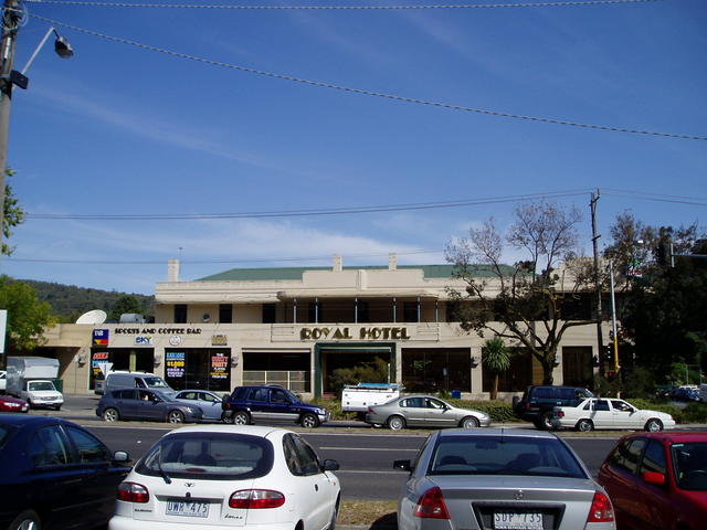
There is a major tourist information centre located almost opposite the Royal Hotel in Upper Ferntree Gully next to the town's railway station. Visit Michael Axel and his team on 97587522 at 1211 Burwood Hwy. click here
**Caravan Parks in the area:
- Wantirna (203 Mountain Hwy)
- Lilydale (Pinehill) (105 Warburton Hwy)
- Warburton Caravan Park (30 Woods Point Road)
Mt Dandenong is actually where I have lived and worked all my life, so if you have any questions about this local area, don't hestitate to !
Cheers, and enjoy this great area that is only 45 minutes from Melbourne.
Happy Pub trailing in Victoria!
Gaz
Gary Pope
0408994799
Introduction: What are Pub Trails?
Want more local trails?
refer to: An Overview of Pub Trails in Victoria
The Dandenongs Pub Trail Location Map
Melbourne - Bayswater
Come in from Canterbury Rd, Mountain Highway or Burwood Highway from Melbourne - but start at the corner of Mountain Highway and Scoresby Rd.
To: Bayswater
Direction: head East
Via Road: Mountain Highway
Local Pubs: Bayswater Hotel
Gazza's spot: (late) Mrs Mortiboy's Wine Centre, now operating as a really convenient drive-through bottleshop - and definitely worth dropping in for a wine fossicking! See Edward!
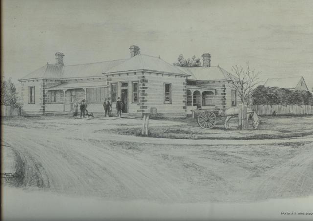
The Bayswater Wine Hall.
The wine hall stands on land that was part of the 'Dandenong Creek Run', a large cattle property in the 1840/50s. A wine licence in this area was held by James John Miller in his original home in about 1880, but in 1895 the licence was transferred to Michael and Catherine Cronin. After Michael Cronin died in 1897, the licence was taken up by Henry Edward Dodd. It was at this time that the Wine Hall was built by Dodd. Before her marriage, Catherine Cronin had established a coach service from Bayswater Railway Station to Olinda in 1889. This is the year the railway line opened from Ringwood to Upper Ferntree Gully. After Michael Cronin's death, Catherine married Henry Dodd and together they operated the coach service in conjunction with the Wine Hall. In 1923, Bertram Stringer purchased the Wine Hall and in 1949, Edward and Gwen Mortiboy leased it. They later purchased the property in 1961, and Gwen went on to run the business up until her death in 2006. Her son, Edward (Jr) now operates the establishment, which is a convenient bottleshop for the locals and passing clients heading up the hills.
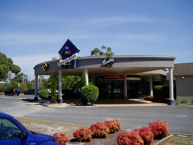 |
Bayswater Hotel »780 Mountain Hwy, Bayswater. |
The Basin
So, here's the secret to our Pub Trail: Mountain Highway
So many people miss the true beauty of Mt Dandenong, travelling the major highways either side of the mountain (Canterbury Rd or Burwood Hwy) rather than the more interesting and picturesque Mountain Highway.
A few points abut Mountain Highway......
The Mountain Highway commences back at the foot of Vermont South near where the East-Link Freeway passes over Burwood Highway. This was once a great apple orchard area, and some orchardists still exist in the area a little south of that area along High Street Road (Yep: That's its full name!). The Mountain Highway then goes up through Wantirna (through what is called the 5-ways where Boronia Rd, Mountain Highway and Wantirna Rd all met once at the same point.) A major Drive-In theatre once existed on this 5-way corner, adjacent to quite a handy Caravan Park, and excellent Mall shopping Centre.
Heading further east, travelling through Bayswater, the Mountain Highway, passes the historical Cobb and Co stopping point at Mortiboy's Wine Bar, and then commences its route up towards The Basin and up the mountain to Sassafrass.
The Basin
From: Bayswater
To: The Basin
Direction: East, towards the mountain
Via Road: Mountain Highway
Local Pubs: The Acorn On Forest
Gazza's spot: Lunch in the park, and a stroll over to the round-about in the middle of The Basin to take in the finest view of Mt Dandenong.
Sassafras
From: The Basin
To: Sassafras
Via road: Mountain Highway
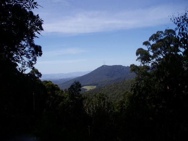
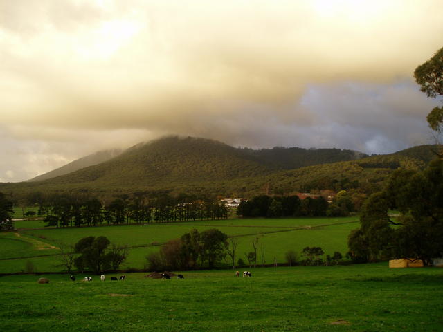
Attractions:Views to Mount Dandenong on your left as you wind up this great stretch of road
Gazza's spot: Antique Shops, Miss Marples (restaurant), gift shops
Miller Homestead, The Basin. One of the original land holders of the area (J.J.Miller) - currently used for weddings and special events by local council.
Location: Cnr Melrose Crt and Dorrigo Drive. (off Mountain Highway about 2km west, short of reaching The Basin township)
Views from the foothills of The Dandenongs (taken from The Basin round-about)
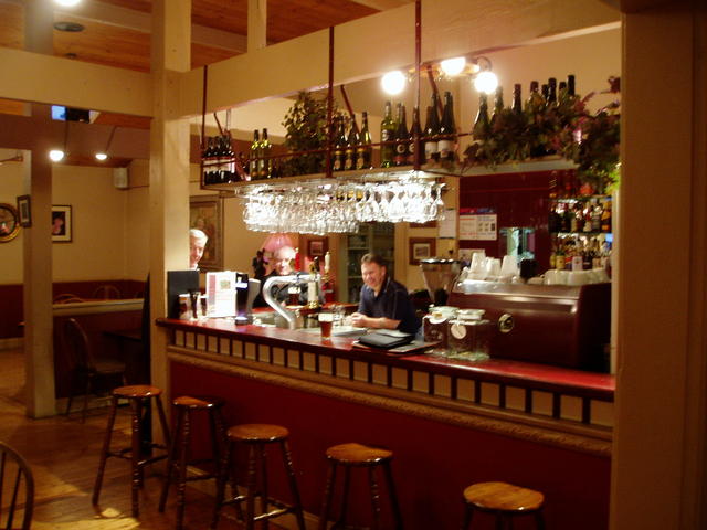 |
Acorn on Forest »Ideal stop for a nice meal, coffee or ale, whilst travelling up the mountain. Now here's a great place to stop and find out more abut the local area. The publican, Mal also provides tours of the area, given enough notice, and has been a keen promoter of the town and the area for some time. Highly recommended..... Gaz! |
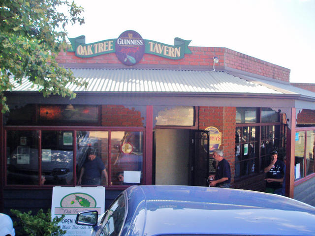 |
The Oaktree Tavern » |
Olinda
Olinda over Mt Dandenong down to Kalorama (Loop)
From: Sassafras
To: Olinda
Direction: Left, North up hill.
Via road: Mt Dandenong Tourist Rd
From: Olinda To: Mt Dandenong
Direction: north along Mt Dandenong Tourist Rd
Via road: then left into Ridge Rd
Attractions: Mt Dandenong Observatory
Local Pubs: Mount Dandenong Hotel
Gazza's spot: Skyhigh restaurant, cafe, observatory. Musk Park Maze, BBQ facilities
From: Mt Dandenong (Observatory)
To: Kalorama
Via Road: Ridge Rd
Attractions: Silvan Dam view
Back on the loop section heading south now to Mt Dandenong and back to Olinda
From: Kalorama
To: Olinda
Via Road: Mount Dandenong Tourist Rd
Attractions: William Ricketts Santuary
Local Pubs: Mount Dandenong Hotel
From: Olinda
To: Monbulk
Via Road: Olinda- Monbulk Rd
Attractions: National Rhodadendron Display. Olinda Golf Course (views galore)
Gazza's spot: hardest golf course to do (did 114 for only 9 holes once!) View to ranges are great!
From: Monbulk To: The Patch
Via Road: Moxham's Rd becomes Prior's Rd. Bear right, as it becomes Kallista-Emerald Rd
Gazza's spot: Great views over the valley and to the mountain ranges of Mt Donna Buang in the distance
From: The Patch To: Kallista
Via Road: Kallista-Emerald Rd

View of Silvan Dam from Kalorama
William Rickett's Sanctuary
 |
Mount Dandenong Hotel »1451 Mt Dandenong Tourist Road, |
Ferny Creek
Kallista up thru Sherbrooke Forest, across highway up to One Tree Hill and down to Tremont (scenic)
From: Kallista
To: Ferny Creek
Direction: West via Sherbrooke
Via Road: Sherbrooke Rd
Attractions: Tindale Gardens, Nicholas Gardens
Gazza's spot: Sherbrooke Forest tall trees to the left of the road.
From: Ferny Creek
To: One Tree Hill
Direction: West (Go across Mt Dandenong Tourist Rd)
Via Road: One Tree Hill Road
Attractions: views of Cardinia Dam way out south (on your left)
Gazza's spot: The former sight of the original One Tree Hill Lookout tower, now a BBQ area at the end of One Tree Hill Rd.
From: One Tree Hill
To: Tremont
Direction: South
Via Road: Churchill Drive
Attractions: views to the Melbourne skyline
Gazza's spot: The old Tremont general store
From: Tremont
To: Upper Ferntree Gully
Direction: via Hughes St and Olivette Ave (just cross the Mt Dandenong Tourist Rd for a while, and cut back onto it again at the famous elbow bend on the corner of Olivette Ave.
Via Road: Hughes Rd to Olivette Ave
Attractions: Vistas
Gazza's spot: View from 53 Hughes Rd
From: Tremont
To: Upper Ferntree Gully
Direction: West down the hill
Via Road: Mt Dandenong Tourist Rd
Attractions: Ferntree Gully National Park. The entrance at the bottom - DO NOT ATTEMPT to enter from the top end: Wheel grates!
Gazza's spot: 1000 steps to One Tree Hill
From: Upper Ferntree Gully
To: Ferntree Gully
Direction: West
Via Road: Burwood Highway
Wind up through the immense fern gullies from Kallista to Sherbrooke
Drive through the tall trees of Sherbrooke Forest as you head towards Ferny Creek, and mount up to One Tree Hill.
Ferntree Gully
To: Upper Ferntree Gully
Road name: Burwood Highway
Pubs in town: Club Hotel; Middle Pub; Royal Taverner Pub
** At this point, Burwood Highway can lead you back to Melbourne, OR you can cut across to The Basin where we started via Forest Rd.
** OR you can slip back east up the edge of the mountain to Belgrave and take the Silvan Dam Trail and into Lilydale from where you can then consider one of three other PUB-TRAILS: a) The SLIDE, b) The SPUR or c) WARBY; taking you up into the north-east side of the Dandenongs and beyond
So, to conclude the loop for this trail, head on to The Basin.
From: Ferntree Gully
To: The Basin
Road name: Forest Rd
Local Pubs: The Acorn On Forest
Well - that concludes the loop around the Eastern side of the Mt Dandenong Ranges. So set a spell, perhaps enjoy a meal in The Basin, before heading off to some accomodation in the area, like Olinda, Sassafrass (just up the Mountain Highway 10 minutes from here) or back to our suggested pivotal towns around Lilydale or Berwick, where you can plan some time to spend in our other nearby Pub Trails!
Happy Pub Trailing!
Gaz
Gary Pope
0408994799
Introduction: What are Pub Trails?
Want more local trails?
refer to: An Overview of Pub Trails in Victoria
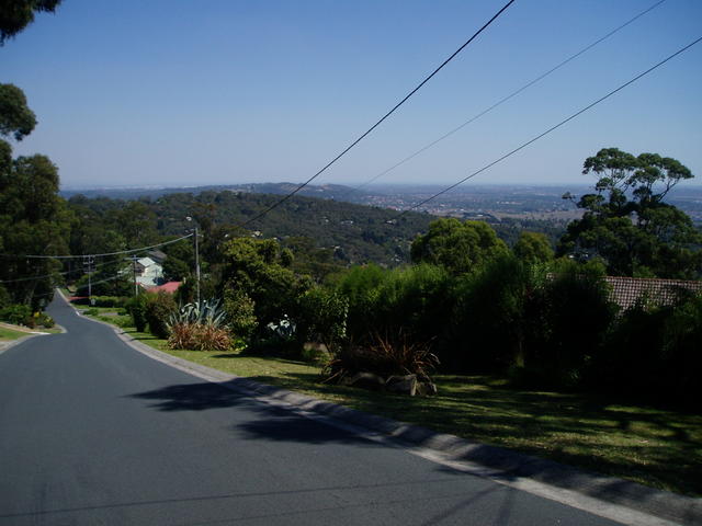
View the beautiful homes in the hills, before descending down to Tremont where you arrive at a private viewing area that stretches to the Melbourne suburbs below.
Ambleside Homestead. Original home and land holdings - now the base for the Knox Historical Society. Contains a great deal of photographic and memorabilia items from the region. (Olivebank Rd, Ferntree Gully - off Forest Rd, 25% the way between Ferntree Gully and The Basin)
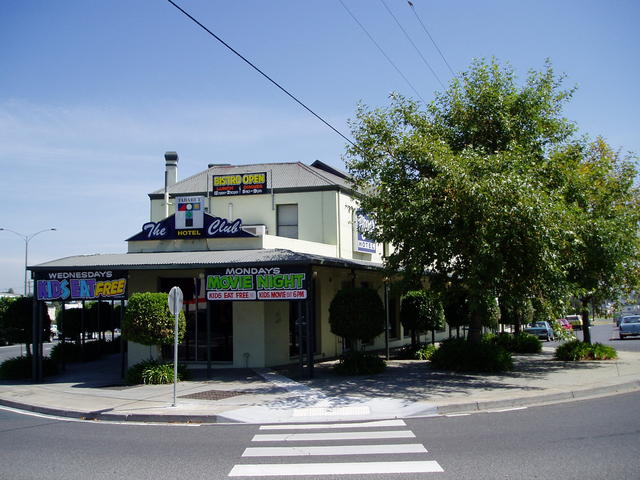 |
Club Hotel »848 Burwood Hwy, |
 |
Ferntree Gully Hotel »1130 Burwood Hwy, |
 |
Royal Taverner Hotel »1208 Burwood Hwy, |
Belgrave
Belgrave connection from Kallista, (Optional)
From: Kallista
To: Belgrave
Via Road: at Kallista, (south), down MONBULK Rd
Local Pubs: Micawbers Tavern
OR, if linking back to Belgrave from Ferntree Gully:
From: Ferntree Gully
To: Belgrave
Via Road: at FTG, (east), up along Burwood Hwy
Local Pubs: Bell Tavern, Micawbers Tavern
To: Belgrave
Via Road: Burwood Highway
Attractions: Puffing Billy vintage railway (train ride to Emerald and back)
Local Pubs: Bell Tavern Micawber Tavern
*** AT THIS POINT you can consider reversing down part of the Silvan Dam Trail south to BERWICK which leads you back to the Princes Highway and from there consider taking the South Gippsland Trail that leads you to Phillip Island thru the Loch Valley ***
Or head back down Burwood Highway, to Ferntree Gully, and pick up the rest of the original Mt Dandenongs trail.
Happy Pub trailing in Victoria!
Gaz
Gary Pope
0408994799
Introduction: What are Pub Trails?
Want more local trails?
refer to: An Overview of Pub Trails in Victoria
 |
Bell Tavern »1645 Burwood Highway, |
 |
Micawber Tavern »Micawbers Tavern |