South Gippsland Pub Trail
South Gippsland and the adjoining Bass Shire area, together, cover some exciting tourist regions to the South East of Melbourne.
The aim of the trails mentioned in this article is to show access from various points along the Prince's Highway (A1 / M1) that lead travellers to the coastal and ranges attractions that lay south of this major highway which runs east/west across the entire state of Victoria.
East to West
We've defined South Gippsland as the region that traverses west from Berwick, in the outer eastern suburbs of Melbourne, through to Warragul. Please refer to the other Prince's Hwy sections Central Gippsland for the continuation from Yarragon through to Sale, and East Gippsland for the stretch from Bairnsdale through to the NSW border near Genoa.
Linking you to the North
Two key towns provide the traveller with access north from this region. From Berwick, use the Silvan Dam Pub Trail. This is ideal for those wanting to stay on the fringe of the eastern suburns at Lilydale (35kms east of Melbourne).
For those literally interested in getting a taste of the Mt Baw Baw region then consider heading out from Warragul, using the Warburton Pub Trail. This will also lead you to Lilydale for access to the areas on the other side of the ranges that form the northern border of the South Gippsland region.
South Gippsland region attractions
As the Prince's Hwy enters the outer eastern suburban area around Pakenham and Berwick, there are two major highways that run closer to the coast below. South Gippsland Highway and Bass Highway stretch around most of the coastal area, and you will end up on these as part of each of the 'drop-down' routes mentioned.
And we've got a clue for Melbournites wanting to visit Phillip Island.
So there is opportunity to zig-zag up and down any number of the trails suggested, depending on what you enjoy doing.
Here's a summary of what's on offer:
- go the 'old road' taking the original Prince's Hwy (not freeway) between Nar Nar Goon (near Pakenham) and Warragul, out along the railway route thru Garfield and Drouin - a nice Pub Trailing route!
- If you've just been cutting down from the North (through Lilydale) using our Silvan Dam trail to Berwick, cut further south via Clyde to Tooradin for an easy bypass of the suburbs to reach the South Gippsland region
- if heading south to Phillip Island for Cowes and San Remo, consider the superb motorcyclist's touring route via Loch and Archies Creek, as a relaxing alternative to the busy Bass Hwy
- if "Coal Country" is your thing, then exit Warragul down through Korumburra and visit Wonthaggi and Leongatha (or reach there from Loch)
- if you enjoy big open sandy ocean playgrounds, then try the combination of open sea beaches and sheltered inlets at Inverloch and around to Venus bay and as far as Sandy Point
- and if bush-walking and nature is of interest, explore the far southern wilderness of the Wilson's Promontory National Park.
And naturally, there's a lot of great country pub trailing to do in these parts! Take a couple of days or a few weeks.... South Gipplsand - a top place to explore.
Happy Pub Trailing!
Gaz
Gary Pope
0408994799
Introduction: What are Pub Trails?
Want more local trails?
refer to: An Overview of Pub Trails in Victoria
South Gippsland Pub Trail Location Map
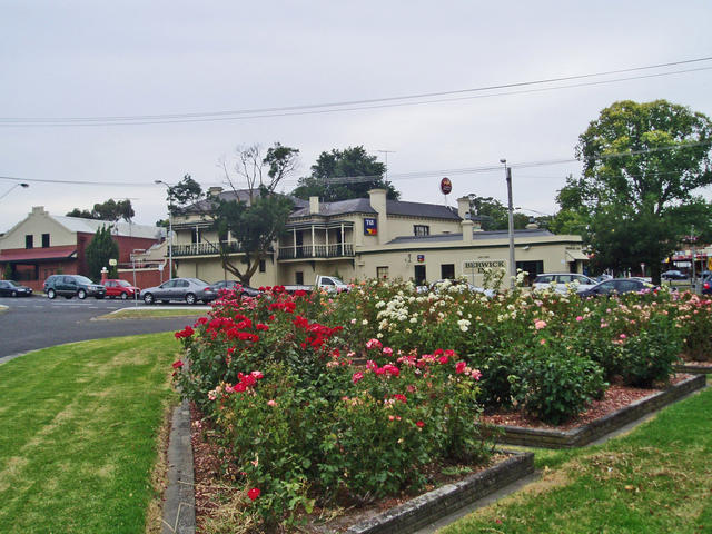
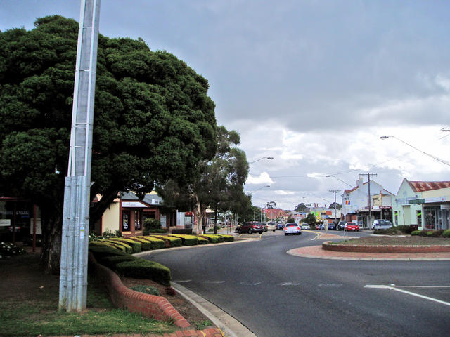
Berwick
Berwick, Tooradin to Koo Wee Rup - bypass the suburbs
Many a local heading south towards Phillip Island, will just take to the South Gippsland Hwy off ramp on the Monash freeway heading out of Melbourne and join into the Bass Highway heading down to San Remo...... But if you've got some time, and enjoy Pub Trailing, you might like to consider an alternative approach.
Let's start in Berwick, and consider a stroll through the town, and enjoy a coffee to start the journey in a relaxed manner.
And of course, if your enjoying our Pub Trailing in reverse, the Berwick Inn is a top spot to enjoy a meal at the end of the journey to here!

Berwick Inn
 |
Berwick Inn »1 High street, |
Tooradin
Berwick, Tooradin to Koo Wee Rup - bypass the suburbs
From: Berwick
To: Tooradin
Take Clyde Rd south to the very end, and head south-east to Tooradin, and consider a stroll along the river front that leads to Tooradin Inlet. Turn right over the bridge where the Tooradin Pub is on the corner.
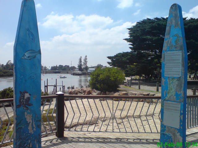
Tooradin Inlet - top spot for launching a boat
 |
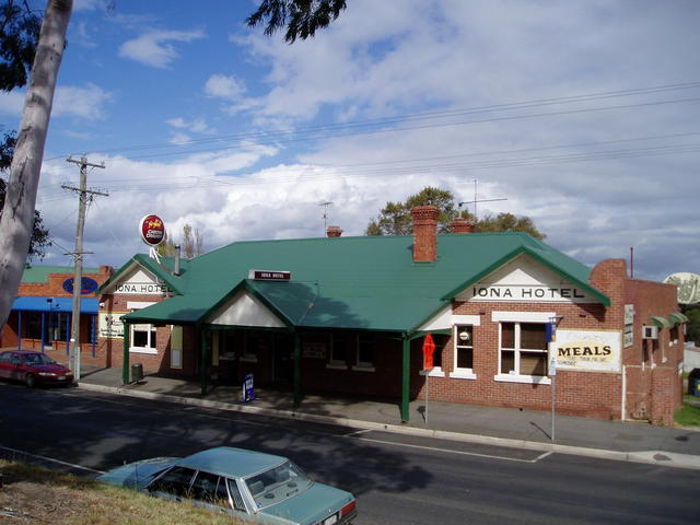
Tooradin Hotel »If you've caught yourself a good catch of fish - then its time to brag about it at the local Tooradin Hotel! 80 Gippsland Highway |
Koo Wee Rup
Berwick, Tooradin to Koo Wee Rup - bypass the suburbs
From: Tooradin
To:Koo Wee Rup
Heading off south, take a slight deviation for a couple of kilometres and check out the township of Koo Wee Rup. You can cut across to Pakenham from here fairly easily too, and pickup the Old Prince's Hwy section that takes you from Nar Nar Goon to Warragul, outlined next.
But if you're travelling south towards Phillip Island, get ready for another detour via Loch and Archies Creek - especially if your a keen motorcyclist!
 |
Royal Hotel »Station St |
Nar Nar Goon
Nar Nar Goon to Warragul - following the railway route thru Garfield
Ah! Now isn't the old Prince's Hwy a treat to drive these days. With the freeway traffic hurtling down the express lanes a few kilometres away, you get to enjoy this picturesque part of the region with absolute ease!
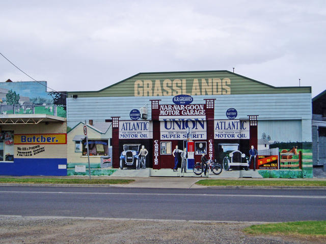
Heading off the main freeway at Pakenham, take the Nar Nar Goon turnoff. This will follow the main railway line, taking you through to the township of Nar Nar Goon - check out all the painted murals!. Then continue on ...
From: Nar Nar Goon
To: Garfield
Via: Tynong
 |
Nar Nar Goon Hotel »The main street of Nar nar Goon - township of murals, adjacent to the Nar Nar Goon Hotel. 2 Nar Nar Goon Rd, |
Garfield
Nar Nar Goon to Warragul - following the railway route thru Garfield
Garfield is full of character, great country pub hospitality of course, and even a picture theatre! Continue on your trail
From: Garfield
To: Bunyip
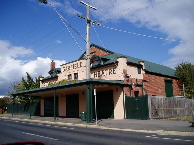
Picture theatre in Garfield.
 |
Garfield Hotel »Garfield Hotel top pub, with plenty of information on the local area to share. 95 Main St, |
Bunyip

Nar Nar Goon to Warragul - following the railway route thru Garfield
The town of Bunyip offers the locals two watering holes.
From: Bunyip continue
To: Longwarry
 |
Gippsland Hotel »Main street of Bunyip with plenty of sporting history at its Top Pub. |
 |
Railway Hotel »14 Main St |
Longwarry
Nar Nar Goon to Warragul - following the railway route thru Garfield
In Longwarry - even a horse finds its way to this local.
From: Longwarry
To: Drouin
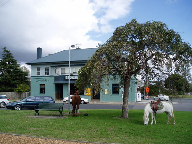
Longwarry Hotel - time to get out of the saddle?
Drouin - a good sized town, with plenty of services for the traveller
 |
Longwarry Hotel »4 Kennedy St |
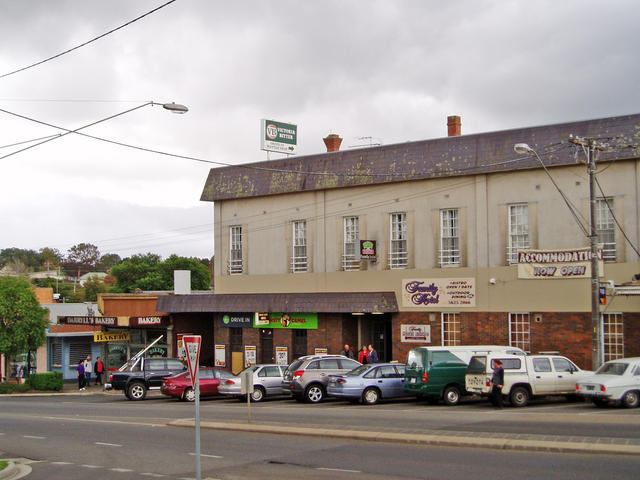
Drouin
From: Drouin
To: Warragul
Via: Drouin East
Emerging at Drouin, you pass back under the freeway at the western end of town and can reach Warragul still travelling the old Prince's Highway.
As with all travelling memories, some towns stand out in your mind. Drouin was home for an unexpected engine failure many years back, and true hospitality of one of the locals who had just finished enjoying a hard earned ale of the day, offered a room for the night whilst plans were made for repairs the next day. The offer was most welcomed, given it was midnight and cold. And I should add, the prompt servicing from the local RACV dealer in town was also a comfort! Sometimes other people's Pub Trailing comes to your rescue! (PS: Thanks Tony!.......)
Now where were we, yes: looking for Warragul!
 |
Family Hotel » |
 |
Royal Hotel » |
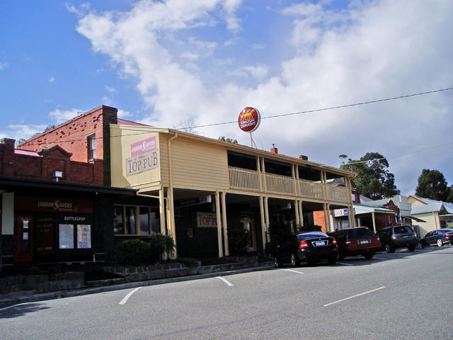
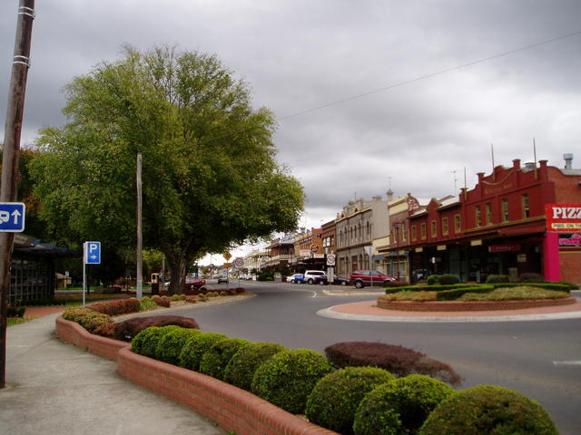
Warragul

Nar Nar Goon to Warragul - following the railway route thru Garfield
Warragul is a town with loads of historical Pub buildings that line Queen St adjacent to the railway at the foot of town. This is an ideal place to park and take a stroll to get a complete view of the ornate building facades.
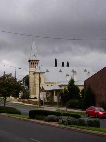
Further into the town, the road splits into two main shopping areas, the left fork taking you up to a series of spired chrches - well worth a look.
From Warragul you have a few choices:
- do the northern loop on the Warburton Trail.
- try the southern trip down into "Coal Country"
- push on into Central Gippsland for more treats
That is, of course, if you've already checked out the southern end of this region for some great ocean views and of course Phillip Island!
Warragul to Korumburra "Coal Country" loop to Wonthaggi, Inverloch and Leongatha
Coal Creek Heritage Village is located in Korumburra, and can be reached from the Prince's Hwy by taking an exit south from Warragul.
Coming down from Warragul gives you the opportunity to explore a couple of areas in Central Gippsland in an orderly fashion, leaving the adjacent loopp around Loch to Archies Creek and over to Phillip Island as a separate itinerary.
Take the Warragul-Korumburra Rd that leads you through Strzelecki to Ranceby and into Korumburra.
From Korumburra, consider a short loop to:
- Wonthaggi (taking in part of the Motorcyclist route outlined previously, down via Myarra and RIGHT through Kongwak, but LEFGT at Lance Creek and through West Creek.
- Slip down to Inverloch with the option of heading further south to Venus Bay and Sandy Point, leading you down to Wilson's Promontory
- Or head from Wonthaggi through Inverloch and back up to Leongatha, to return to Korumburra, if you are considering heading west towards Phillip Island or up to Melbourne.
Queen St comprises a number of excellent hotels in Warragul.
Heading up the Victoria St out of the main shopping street of Warragul
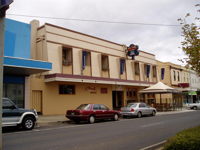 |
Club Hotel »51 Queen St |
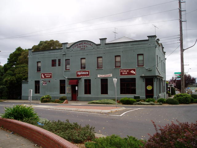 |
Commercial Hotel »115 Queen St |
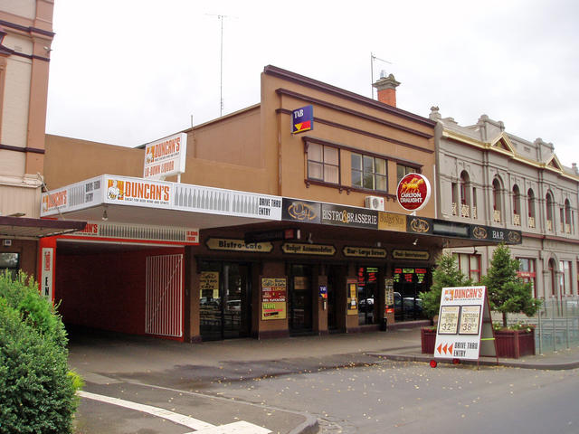 |
O & H Bar & Bistro »95 Queen St |
 |
Railway Hotel »81-85 Queen St |
 |
Former Liberty Inn » |
Archies Creek
Phillip Island via motorcyclist's superb touring route through Loch and Archies Creek
Phillip Island is the home of Grand Prix motorcycle racing, amongst its many other attractions. So the Bass Hwy heading down through San Remo, over the bridge and onto Phillip Islland can be pretty busy in peak tourist times.
But just a few kilometres east of the Bass Hwy, the motorcyclists (and car enthusiasts) have discovered a great drive to enjoy, and you should consider part of it, as a nice detour on your way south to the Island.
Here's the motorcyclist's loop:
From Grantville, on the Bass Hwy, take a left to Glenn Forbes through to Woolami and head across to Archies Creek.
From Archies Creek, spin out through Korrine to Kongwak, up through Moyarra, Jumbunna to Korumburra.
From Korumburra, travel up to Ranceby into Poowong and over to Loch. From Loch, head down to Woodleigh and out to Grantville, back on the Bass Hwy to complete the loop.
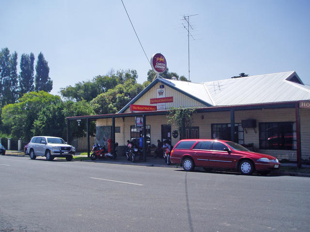 |
Royal Mail Hotel »A few local motorcyclists enjoying a stop at The Royal Mail Hotel in Archies Creek 89-91 Archies Creek Rd |
Loch
Phillip Island via motorcyclist's superb touring route through Loch and Archies Creek
A shorter version
for those just wanting a pleasant diversion from the Bass Highway
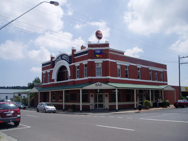
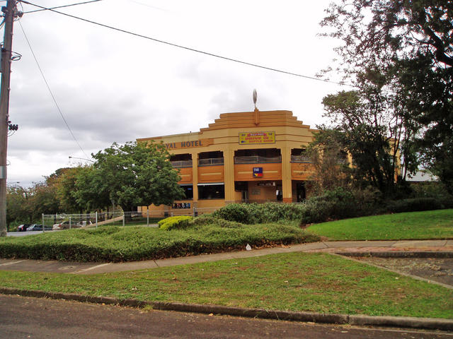
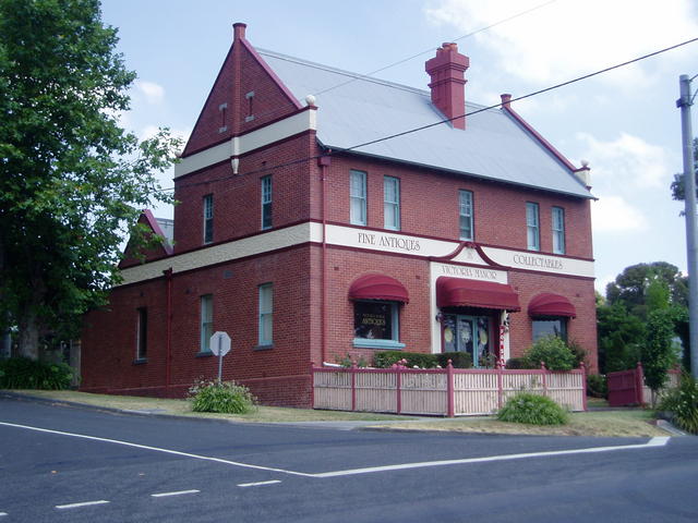
Heading south from Tooradin or Koo Wee Rup, stay on the South Gippsland Hwy, bearing left towards Korumburra, just after the Lang Lang exit. But just travel to the township of Loch, which requires a right turn into the town from the highway. Drop into Sybil's place: The Royal Hotel - highly recommended.
Loch is a great little town to have a look around, before taking a countryside drive south via the Wonthaggi-Loch road, that starts in the middle of town.
Head south through Krowera and on to Blackwood Forest and to the intersection at Ryanston - where you take a RIGHT turn to drive down into Archies Creek. Now here you'll find the Royal Mail Hotel, which has a heap of interesting Pubobilia to enjoy, and a beaut little front bar.
Head off south-west out of town to Dalyston, to reach the Bass Hwy. From here its a scenic ocean drive west to Kilcunda and up to the turn off for San Remo and over to Phillip Island.
Warragul to Korumburra "Coal Country"
Beautifully presented accomodation rooms at The Royal Hotel in Loch
 |
Royal Hotel »Syb's Place - top noche food, and great atmosphere for a stop over or that special occasion at the Royal Hotel in Loch 2 Smith St |
Inverloch
Inverloch ocean and inlet, to Venus bay and Sandy Point
Inverloch is ideally reached from Korumburra either out of Melbourne via the South Gippsland Highway, or south from Warragul from the Prince's Hwy.
Inverloch boasts open sea beaches as well as sheltered inlets, and is a poopular summer time destination.
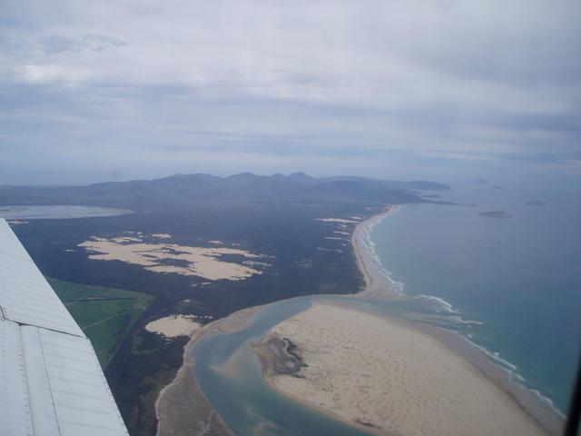
It is also a good launching point for exploring the coastline eastward, around to Venus Bay and meandering around the huge sand dunes at Sandy Point.
A number of towns in the area to check out:
- Venus Bay
- Tarwin Lower
- Meeniyan
- Fish Creek - access to Yanakie to Wilson's Promontory
- detour in and out of Sandy Point
and explore the surrounds of Waratah Bay
Depending on how you arrived to this area, consider heading to Korumburra for the loop access to Phillip Island, or refer to our Central Gippsland Pub Trail for intineraries leading out to the Tarra-Bulga National Park (Grand Ridge Rd) or further east around the coast through Foster to Yarram and up to Traralgon to join back to the Prince's Hwy.
Wilson's Promotory National Park
For bush-walking and tremendous natural rock and cliff attractions, explore the far southern wilderness of the Wilson's Promontory National Park
...... so, where to next?
Time to leave South Gippsland and head back along the Prince's Highway to explore some more interesting detours off the main road......
Or maybe its time to set a spell, enjoy a hearty meal at one of the great Aussie Pubs we've introduced to you, and hit the sack, ready for another day of touring the area tomorrow!
Happy Pub Trailing!
Gaz
Gary Pope
0408994799
Introduction: What are Pub Trails?
Want more local trails?
refer to: An Overview of Pub Trails in Victoria
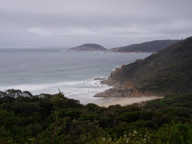
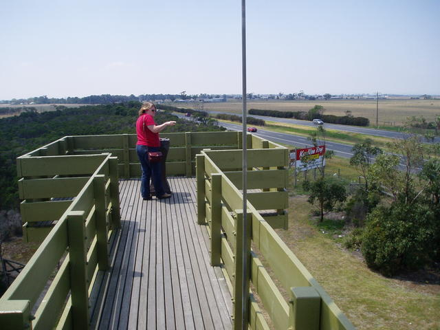
Secluded beaches surround the Prom.
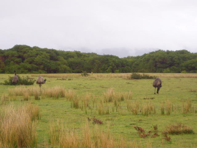
Emus grazing at the entrance to Wilson's Promontory, wouth of Yanakie entrance to the National Park